Friday, May 12, 2017

Route 66, Hoover Dam, Las Vegas and Death Valley 9, 10, 11 May

We were very lucky with the beautiful weather at the Grand Canyon, as it turned rainy and cold the morning we left.  Very soon we encountered snow.


  At Williams, we joined the historic Route 66 for a while.


  Plenty of these old cars to be seen. 


  We had lunch at the traditional Road Runner Dinner at Seligman on Route 66.


  This is the graceful curve of the Hoover Dam, named for President Herbert Hooper and commenced in 1931.  At 726 feet high, it is one of the tallest in the world.   By then we were pretty close to Las Vegas and the weather was much warmer.


   The Colorado River behind the dam forms Lake Mead.  Sometimes the level is up to the top of the white rock.


    The bridge high over the Colorado River.


  Looking across the whole dam from the walkway of the bridge.


  Lights of the Las Vegas Strip.  


  The fountain show at the Bellagio Hotel where we stayed last time.


    Driving down the strip by day.


    The Red Rock Canyon Conservation Area, a bit over half an hour's drive from Las Vegas, was our destination for the day.  It was created around 65 million years ago.


    At the Calico Hills.


   Bill trying out a waterfall coming from the top of the rocks on the Lost Creek Trail.


    The trail head leading up to the falls.


Next day it was with trepidation that we headed into Death Valley National Park.  The temperature was 106 degrees, not bad considering they have had the highest maximum temperature ever recorded world wide, 134 degrees. This is the Thelma and Louise shot.


  Dante's View, the name inspired by Dante's Inferno.


   Looking down from Dante's View to the Badwater Basin, 86 metres below sea level.  This is the lowest spot in North America.


   Zabriskie Point.  There was a famous 1970 movie of the same name.


  The point is surrounded by multiple layers of wildly eroded sedentary mudstone rocks.  Quite weird really.


  The Harmony Borax Works mine near Furnace Creek.


   Last stop in Death Valley, the sand dunes, 36 square kilometres of them.

Grand Canyon 7, 8 May


   We left Sedona for the Grand Canyon via the lovely Oak Creek Canyon Road.


  On the way we stopped at a few National Parks.  This is a trail at Walnut Canyon.  More than 800 years ago, many Native Americans sheltered in the cave dwellings along the ridges of these rocks.


   During spring and summer they built pit houses on the rim, so they could grow crops.


  A desert horned lizard.


     Indian paint brush


Next stop, Sunset Crater Volcano which erupted most recently around 1040.  There are lava fields as far as the eye can see.


    A  Mormon Tea bush containing various stimulating alkaloids.  Mormons used it as a substitute for coffee and tea, which they were not allowed to drink.


  Wupatki Pueblo, a multi level, high rise dwelling with about 100 rooms.  There are many other dwellings on this land, dating from about the 1100s when many puebloan people came together to build a vast farming community.


  By early evening we had arrive at the Grand Canyon via the east entrance.  This is the watch tower at Desert View.


  The mighty Colorado River is but a speck from this distance. The canyon is 277 miles long and approximately 10 miles wide.


  Our hotel, El Tavor, an historic park lodge, opened in 1905 when the Santa Fe railroad reached the Grand Canyon.


  We spent all the next day walking as much of the rim trail as we could.  You can see the extremely steep trail down.  It takes hours down walking and double that time up again.  That's why we decided to stick to the rim.


  On the edge!


  There is great variety in the colour of the rocks.


H

   Looking way down to the Colorado River, you can see part of the trail and the bridge at the bottom, as well as some boats.  Boat travel is strictly controlled by the National Park people.


  A chipmunk.


  Bill at Hopi Point.


  Hopi point with the Colorado River way below.


  Lots of mule deer around the camp grounds here. 

Wednesday, May 10, 2017

Sedona Arizona 4,5,6 May

  
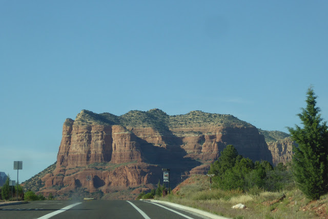
   Sedona is a stunning town in Arizona surrounded for miles by red rock mountains.  We arrived via the scenic road past the village of Oak Creek.  This is Bell Rock.


  The view from our hotel, which was circled by red rocks.


  The first thing we did was go on a four wheel drive Pink Jeep Tour, up onto the rocks.  Pretty scary at times.  These rocks are steeper than they look in photos.


  Of course Bill took it in his stride.


  We were on the Broken Arrow trail.


  High above it all!


  Enjoying time out of the Bumpy Jeep.


  If you can see the white line of calcium, that is where a dare devil mountain bike rider rode.  More than one actually.  There is no ridge!  See it on You Tube, Riding the White Line Sedona.


  This is Snoopy Rock, head on the left, feet on the right.


  Sunset from the hotel.


  Next day we took a walk in Fay Canyon.


  Spring flowers everywhere again.  Not sure what these are.


  We scrambled up a rocky trail to see this natural arch along the way.


  Nearly there!


  Colourful butterflies mating.


  At Tlaquepaque in town, there was a Mexican festival happening.


  Lots of colourful dancing and music.


  Bill checks out the workmanship.


   In full bloom.


  The Chapel of the Holy Cross, cut into the rocks above Sedona.


 It’s very spectacular inside.